
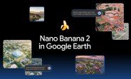
Google has integrated its advanced Nano Banana 2 AI image generation model into Google Earth, enabling users to create custom visuals directly from the platform’s vast library of satellite, aerial, and 3D imagery. This new feature opens up creative possibilities for educators, travelers, and anyone exploring the world from their screen.
How to Use Nano Banana 2 in Google Earth
Using the tool is straightforward. Simply zoom in to any location on Google Earth via the web, click the “create image” button, and type a description of the scene you want to see. Nano Banana 2 then processes your request and generates a unique image based on the real-world geography and your prompt.
Step-by-Step Guide
- Open Google Earth on your web browser.
- Navigate to a specific place, like a city, landmark, or natural area.
- Select the “create image” option from the interface.
- Enter a descriptive prompt, such as “a bustling market in ancient Rome” or “a futuristic skyline over Paris.”
- Wait a few seconds for Nano Banana 2 to generate your custom image.
Practical Applications for Education and Beyond
Google highlights that teachers can use this feature to bring history and geography to life. For instance, they can transform the ruins of Pompeii into a vibrant Roman city, complete with realistic details like architecture, people, and daily activities. This allows students to visualize historical events in a hyper-realistic way, enhancing engagement and understanding.
Creating Custom Infographics
Beyond historical scenes, users can generate custom infographics. For example, you could overlay data visualizations onto a map of a region, showing population density, climate patterns, or economic activity. This makes complex information more accessible and visually appealing.
Technical Capabilities of Nano Banana 2
Nano Banana 2 builds on Google’s previous AI models, offering improved resolution, faster generation times, and better understanding of geographic context. It can blend real-world satellite imagery with creative elements, ensuring that generated images remain grounded in actual locations while allowing for artistic or educational modifications.
Limitations and Future Potential
While the tool is powerful, it may sometimes produce unexpected results if prompts are too vague. Google recommends using specific, descriptive language for best outcomes. The company plans to expand the feature to mobile versions of Google Earth in the coming months, along with additional customization options.
What This Means for Users
This integration democratizes image creation, making it accessible to anyone with an internet connection. Whether you’re a teacher designing a lesson, a content creator looking for unique visuals, or a curious explorer, Nano Banana 2 in Google Earth offers a new way to interact with our planet.